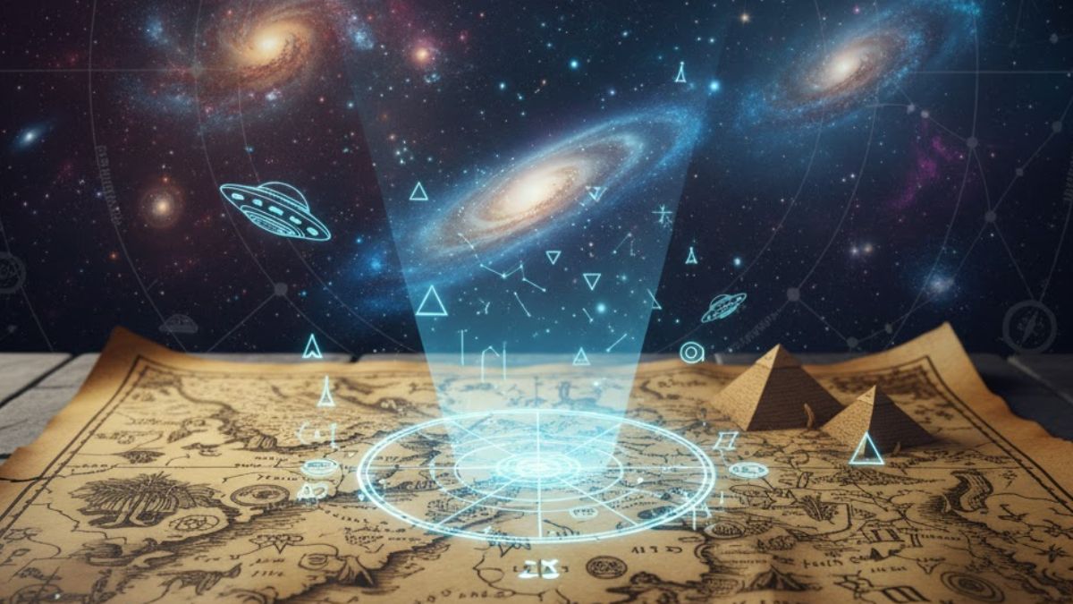
There’s a quiet magic in looking at an old map. The yellowed paper, the faded ink, the strange sea monsters drawn in uncharted waters—it feels like a message from another time. We see these maps as beautiful, but primitive; a best guess from a world without satellites or airplanes. But what if we’re looking at them all wrong? What if some of these ancient charts are not just guesses, but records of something incredible?
For centuries, historians have puzzled over maps that seem to know too much. Maps created by explorers who, by all accounts, should have been sailing into the complete unknown, yet their drawings show coastlines and landmasses with startling accuracy. Some even appear to depict parts of the world, like the frozen coast of Antarctica, that wouldn’t be officially “discovered” for hundreds of years.
This leads us down a fascinating and controversial path. If these mapmakers didn’t have the technology to see the Earth from above, and if they hadn’t traveled to these distant lands themselves, how did they know what to draw? One of the most intriguing theories suggests that ancient civilizations may have had help from a source far beyond our world. Could these precise maps be clues, left behind in parchment and ink, pointing to visitors from the stars?
What if the most accurate world maps existed long before modern technology could ever create them?
What is the Piri Reis Map, and Why is it So Mysterious?
In 1929, a group of historians working in the Topkapi Palace in Istanbul made a stunning discovery. They found a map, drawn on gazelle skin, dated to the year 1513. It was signed by a Turkish admiral and cartographer named Piri Reis. On it, he noted that his map was based on twenty different source maps, some of which dated back to the time of Alexander the Great. This in itself is fascinating, but the real mystery lies in what the map depicts.
The Piri Reis map shows the western coast of Africa, the eastern coast of South America, and the northern coast of Antarctica. The problem is, Antarctica wasn’t discovered until 1820—over 300 years after this map was drawn. Even more baffling is the detail of the Antarctic coastline. The map shows what looks like the continent’s landmass before it was covered in ice. Modern science, using seismic surveys, has only recently been able to map the subglacial topography of Antarctica, and it bears a strange resemblance to the Piri Reis drawing.
So, how is this possible? How could a 16th-century sailor map a continent that was buried under a mile of ice? Supporters of the ancient aliens theory propose a compelling idea. They suggest that the source maps Piri Reis used were copies of copies, tracing back to a much older, highly advanced civilization. This civilization, perhaps with the guidance of extraterrestrial beings, possessed the technology to map the planet from the air. The knowledge was lost, but fragments survived, eventually making their way into the hands of cartographers like Piri Reis. It’s a theory that turns our understanding of history on its head, suggesting that our ancestors had access to a global perspective they should never have had.
How Could the Zeno Map Accurately Show Greenland’s Geography?
Another map that fuels this mystery is the Zeno Map, published in 1558. It was based on the voyages of the Zeno brothers from Venice in the late 14th century. The map depicts the North Atlantic, including places like Scotland, Iceland, and Greenland. While the map has some obvious inaccuracies, its portrayal of Greenland is what catches the eye.
Greenland is shown not as one large landmass, but as a collection of separate islands. For centuries, this was considered a major error. However, when modern scientists used ice-penetrating radar to study Greenland’s geology, they found something astonishing. Beneath the massive ice sheet, the land is indeed composed of several large islands, separated by deep waterways. The Zeno Map, drawn over 400 years before this scientific discovery, appears to be correct.
This raises a profound question. How did medieval explorers, with their simple ships and tools, understand the true geography of a land buried under ice? The conventional explanation is that it was a lucky guess or based on stories from Norse settlers. But the precision is hard to dismiss. The alternative theory is that the Zeno brothers, like Piri Reis, had access to ancient source material. This material could have contained geographical knowledge passed down from a time when the Earth was warmer, and Greenland’s icy secrets were visible, or from a time when advanced knowledge was shared with humanity by otherworldly visitors.
Who Was Creating Maps with an Overhead View?
Most ancient maps are drawn from a ground-level perspective. They show coastlines as a sailor would see them from his ship, with details getting fuzzier the further inland you go. But some maps are different. They seem to be drawn from a bird’s-eye view, as if the cartographer was floating high above the Earth.
A great example is the maps created by the Oronce Finé in the 1500s. His map of Antarctica, which he called “Terra Australis,” is remarkably detailed. It shows rivers, mountains, and a central sea. Again, this was decades before the continent was discovered. To draw a map with such internal detail, you need to have a comprehensive view of the land. You can’t just sail along the coast and guess what’s in the middle.
This kind of mapping requires a technology that simply did not exist in the ancient or medieval world. It requires aerial surveying. So, if humans didn’t have balloons, airplanes, or satellites back then, who provided the perspective? The ancient astronaut theory suggests that this knowledge could have come from extraterrestrial beings who shared a view of our planet from their spacecraft. These visitors might have provided the “source maps” that later cartographers copied, not fully understanding the advanced science behind them. The maps, then, become not just navigation tools, but fossilized evidence of a close encounter.
Did Ancient Civilizations Have Technology We Don’t Know About?
The most common counter-argument to the ancient aliens theory is that we simply underestimate our ancestors. Perhaps they were far more advanced explorers and scientists than we give them credit for. Maybe they had sophisticated tools and methods that have been lost to history.
It’s true that human ingenuity is powerful. The Polynesians, for instance, navigated vast stretches of the Pacific Ocean by reading the stars, waves, and bird patterns. Could other cultures have developed equally brilliant, but different, techniques for mapping? It’s possible. But the leap required to map a continent under ice is enormous. It implies a level of geological and technological understanding that rivals our own modern capabilities.
If ancient civilizations did possess such advanced technology, what was it? And why is there no clear archaeological evidence for it? The lack of physical evidence for complex mapping tools is a big hole in this argument. This absence is what makes the ancient aliens hypothesis so persistent. It offers an explanation for the “how.” If a more advanced species shared their knowledge, it would have been a conceptual gift, not a technological one. The humans understood what the world looked like, but not necessarily how their teachers knew it. This could explain why the knowledge appears in maps but not in the tools used to create them.
What Do These Maps Tell Us About Lost Civilizations?
Many of these mysterious maps claim to be based on sources from legendary, lost civilizations. Piri Reis wrote about using source maps from the “Library of Alexandria,” a place of mythical knowledge that was destroyed in ancient times. The idea of a lost, advanced human civilization, like Atlantis, is often tied into this mystery.
Perhaps there was a great human civilization during the last Ice Age that was wiped out by a cataclysm, like a great flood. This civilization might have achieved a high level of scientific knowledge and mapped the world. The survivors of this catastrophe could have scattered this knowledge, which later resurfaced in fragments. In this scenario, the ancient aliens aren’t necessary. The mystery becomes a human one—a lost chapter in our own history.
However, this theory has the same problem: a lack of concrete proof. While there are myths and legends about great floods and lost cities all over the world, definitive archaeological evidence for a global, technologically advanced prehistoric civilization has never been found. So, the debate continues. Were our ancestors the brilliant survivors of a lost world, or were they the students of star-bound teachers? The maps don’t give us a clear answer, but they keep the question alive.
How Do Mainstream Historians Explain These Maps?
It’s important to ask how conventional science addresses these mysteries. Mainstream historians and cartographers have proposed several logical explanations. They suggest that these “accurate” features are often a combination of lucky guesses, misunderstood notations, and later alterations.
For instance, the land on the Piri Reis map identified as Antarctica might actually be a distorted version of the southern coast of South America, a place early explorers knew existed but hadn’t fully mapped. Cartographers often filled empty spaces on their maps with speculative landmasses based on rumor and myth. The “accuracy” we see might be us, with our modern knowledge, interpreting old symbols in a way that fits our narrative—a phenomenon called confirmation bias.
Furthermore, many of these maps have been studied and found to be not as accurate as they first appear. They contain numerous errors and fantastical elements that are often ignored by proponents of alternative theories. The scientific community largely agrees that while these maps are incredible historical artifacts, they are products of human exploration, myth, and error, not evidence of extraterrestrial contact.
Why is the Idea of Ancient Alien Cartographers So Compelling?
Even with the scientific explanations, the idea of ancient alien mapmakers continues to capture our imagination. Why is that? It speaks to a deeper human curiosity about our origins and our place in the universe. The thought that we are not alone, and that we may have been visited in our past, is a powerful one.
These maps are tangible objects. We can see them in museums, we can study their lines and notes. They are a real, physical link to this mystery. They make the idea of ancient astronauts feel more concrete. It’s one thing to talk about giant pyramids or strange cave drawings; it’s another to hold a 500-year-old map that seems to contain impossible knowledge.
This theory fills the gaps in our historical record with a sense of wonder. It suggests that human history is far more exciting and mysterious than our textbooks tell us. It proposes that the greatest discoveries about our past are still waiting to be made, not just by digging in the dirt, but by re-examining the artifacts we already have with a more open mind.
Conclusion: A Mystery Written on Paper
The enigma of the ancient maps remains. Are they proof of lost human genius, or evidence of otherworldly guidance? Perhaps they are a mix of both—a testament to the incredible skill of ancient explorers combined with fragments of knowledge from a source we have yet to fully understand.
These old pieces of parchment challenge us to think differently about history. They remind us that the past is not a simple, linear story, but a complex puzzle with missing pieces. Whether you believe in the ancient astronauts theory or not, these maps undeniably hold secrets. They are a silent invitation to keep questioning, to keep exploring, and to never assume we have all the answers.
If these maps are a message, who do you think was trying to send it, and what were they trying to tell us?
FAQs – People Also Ask
1. What is the most famous mysterious ancient map?
The Piri Reis Map of 1513 is the most famous, as it appears to show the coast of Antarctica without its ice cap, a feat thought impossible for the time it was created.
2. Has Antarctica always been covered in ice?
No, Antarctica was not always frozen. It was a temperate continent with rivers and forests millions of years ago, but it has been covered in a thick ice sheet for at least the last 15 million years.
3. What is the ancient astronaut theory?
The ancient astronaut theory suggests that extraterrestrial beings visited Earth in the distant past and made contact with early humans, sharing advanced knowledge that influenced the development of our technology, architecture, and cultures.
4. Did ancient humans have the ability to map the world accurately?
Ancient humans were skilled navigators and cartographers for their known world, using stars, sun positions, and dead reckoning. However, accurately mapping continents they couldn’t have visited, especially under ice, seems beyond their technological capabilities.
5. What is the Oronce Finé map?
Drawn in 1531, the Oronce Finé map depicts a large southern continent, “Terra Australis,” with detailed geographical features like rivers and mountains, long before Antarctica was discovered.
6. How do scientists explain the accuracy of the Piri Reis map?
Mainstream scientists often argue that the land identified as Antarctica is likely a misrepresentation of the Patagonian coast or a hypothetical southern continent that cartographers believed must exist to balance the world’s landmasses.
7. Are there other maps like the Piri Reis map?
Yes, other maps like the Zeno Map (1558) showing Greenland’s subglacial geography and the Buache Map (18th century) also display seemingly anachronistic geographical knowledge.
8. Could these maps be hoaxes?
Most of these maps are considered genuine historical artifacts by scholars. The debate is not about their authenticity, but about the source and interpretation of the geographical information they contain.
9. What was the Library of Alexandria?
The Library of Alexandria was one of the largest and most significant libraries of the ancient world. It was destroyed in a fire, and the loss of its vast collection of scrolls is considered a major tragedy, as it may have contained priceless ancient knowledge.
10. Is there any physical evidence of ancient aliens?
There is no widely accepted physical evidence in the scientific community that proves the existence of ancient aliens. The theory is primarily based on interpreting ancient structures, artworks, and texts in a new way.